If you own property in Brown County, Ohio, or are planning to buy land, understanding property boundaries and parcel details is essential. Many property owners feel confused when trying to locate accurate boundary lines, ownership records, or tax-related information. This is where Brown County GIS Maps become an invaluable resource.
A GIS map is not just a basic map. It connects property lines, parcel numbers, ownership data, zoning, and tax records into one visual system. Home buyers, landowners, real estate professionals, and developers across Brown County rely on this tool to avoid costly mistakes and make informed decisions.
In this complete guide, you will learn how to use the Brown County GIS map step by step, what information it provides, how accurate the data is, and when a legal survey is required. All information is based on official county records maintained by the Brown County Auditor, making this guide reliable, practical, and easy to follow. For additional details, you can also explore the Brown County property search tool for ownership and tax records.
Using the Brown County GIS map, you can quickly view parcel locations and property boundaries without visiting the auditor’s office.
What Is the Brown County GIS Map & Parcel Data?
The Brown County GIS map is a Geographic Information System that displays official land records, parcel boundaries, and property data in an interactive map format. It is maintained using data from the Brown County Auditor’s office and other county departments .The map clearly shows parcel boundaries, helping users understand the exact extent of their property. Each parcel provides detailed property data, including owner information and acreage
In simple terms, the GIS map allows users to:
- View property boundaries visually
- Identify parcel numbers linked to an address
- Access ownership and acreage information
The data comes from recorded deeds, surveys, and public land records. While the GIS map is considered an authoritative county resource, it is designed for reference and planning purposes rather than legal boundary determination.
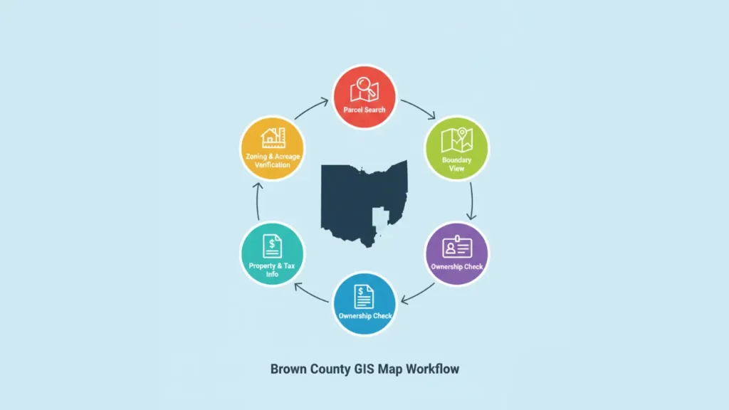
How to Use the Brown County GIS Map to Find Property Boundaries
Using the Brown County GIS map is straightforward once you understand the basics.
- Open the official Brown County GIS map
- Enter a property address or parcel number in the search bar
- Zoom in or out to clearly view parcel boundaries
- Turn map layers on or off, such as aerial imagery or zoning
- Click on a parcel to open detailed property information
Follow these steps to quickly locate property boundaries and ownership details on the Brown County GIS map This process allows you to quickly review land records without visiting a county office.
What Parcel & Ownership Information Can You Find on the GIS Map?
The Brown County GIS map provides much more than just boundary lines.
- Parcel boundaries and lot shape
- Property owner name (public record)
- Acreage and land size
- Zoning classification
- School district information
- Direct access to Brown County property taxes
For users researching tax amounts or payment history, the GIS map connects seamlessly with official tax records.You can perform a simple property ownership lookup to verify the current owner before making any transaction
How to Verify Property Boundaries in Brown County Using GIS
Property boundaries shown on the GIS map are visual representations, not legally binding measurements. They are useful for planning, estimating land size, and understanding parcel layout .For planning purposes, the property boundary map allows users to visualize exact lines before purchasing or surveying
It is important to understand the difference:
- GIS boundaries are for reference
- Legal surveys define enforceable property lines
Fences, driveways, or landscaping may not align exactly with GIS boundaries. If you are involved in a property dispute, construction project, or land transfer, hiring a licensed surveyor is strongly recommended.
Disclaimer: Brown County GIS maps are provided for reference purposes only and should not be used as a substitute for a professional land survey.
Brown County GIS Map vs Auditor Property Search: Which to Use?
| Feature | GIS Map | Auditor Property Search |
|---|---|---|
| View format | Interactive map | Record-based listings |
| Best use | Boundaries and location | Ownership and valuation |
| Data depth | Visual + summary info | Detailed tax and value data |
| Ideal users | Buyers, planners | Taxpayers, researchers |
The GIS map excels at visualizing land and parcel layout, while the Brown County property search tool provides deeper ownership and tax details. Using both together delivers the most accurate results.
Common Issues When Using Brown County GIS Maps
Some users encounter minor challenges when using GIS tools.
- Property address does not appear in search results
- Slow loading on mobile devices
- Parcel boundaries do not match visible fences
- Aerial imagery may not be fully up to date
When this happens, searching by parcel number instead of address usually produces better results. Verifying details through the Brown County Auditor is also recommended.
Who Uses Brown County GIS Maps in Brown County?
Brown County GIS maps serve a wide range of users:
- Home buyers reviewing land boundaries
- Property owners verifying parcel details
- Realtors confirming listing accuracy
- Surveyors referencing parcel layouts
- Developers analyzing zoning and land use
This broad usage highlights the map’s importance as a trusted county resource.
Conclusion & Next Steps for Using GIS Maps
Brown County GIS maps provide a reliable and convenient way to explore property boundaries, ownership details, and land records. They help users save time, reduce confusion, and make informed real estate decisions using official county data.
For detailed ownership, valuation, and tax information, be sure to use the Brown County property search tool alongside the GIS map. Always remember that while GIS maps are excellent planning resources, legal matters involving property lines should be handled by a licensed surveyor.
FAQs
Is the Brown County GIS map legally binding?
No. The GIS map is for reference only. Legal boundary determinations require a professional survey.
How accurate are property boundaries on the GIS map?
The data is based on official records, but boundaries are approximate and should not replace surveyed measurements.
How often is the GIS map updated?
Updates occur as new deeds, parcel changes, and official records are processed by the county.
Can I print or download GIS maps?
Yes. Most GIS systems allow users to print or export map views.
What should I do if my address is not found?
Try searching by parcel number or verify details through the auditor’s records.